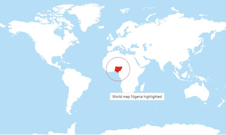
Where is Nigeria on the Map
Posted by Timige, On 22 Jul, 2022 | Updated On 23 Jul, 2022 No Comments »

Where is Nigeria on the map, is a question several citizens of the world want to know.
Nigeria is a west Africa country. It has her borders with Benin Republic at the West, Niger at the North and Cameroon and Chad at the East. It has her coast along Atlantic Ocean on the Gulf of Guinea.
Nigeria is a West African country in the northern and eastern hemispheres of the earth. As part of the western coastline of Africa, Nigeria is well known for its plateaus highlands and rivers.
Abuja is Nigeria’s capital, Lagos is the most populous and Ibadan is the largest city.
The country borders Chad Republic and Niger on the north, the Atlantic Ocean on the south, Benin republic on the west and Cameroon on the east.
Longitude and latitude of Nigeria are 9.0820° N and 8.6753° E respectively.


Do you have question or opinion about this post? Make it in the comment below.
Please Share with Your Friends/Followers
Get Current with Nigeria, Subscribe Now!
Related Posts
Previous Post: « U.S. Court Jails Nigerian Fintech Executives for $167 Million Money Laundering
Next Post: Are There US Soldiers Based in Nigeria Now »
- This Nigeria World Post is Tagged with:
- Nigeria Map |
- Question


Leave a Reply